Halls, rooms, stands & decks
Living maps,
properly made.
Maps that change with every event in your halls, rooms, stands and decks. Visitors open them from a link on their phone.


Your venue, and every event in it.
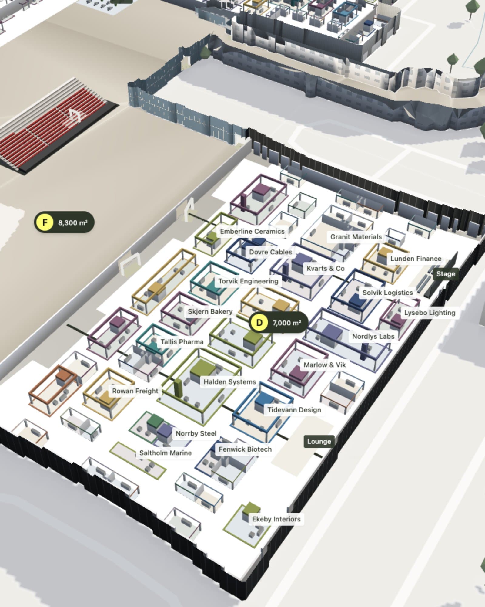
A venue hosts a new event every week, each with its own floor plan. Mapfloors maps the building and each show in it, so every organiser who books your halls receives a map with the booking.
The venue
Mapped from your plans.
Halls, floors, entrances and the way in from the street, drawn from your architect’s plans and reviewed by you before launch.
- Halls and floors
- Entrances and loading doors
- Train, bus and car parks
- Food, toilets and first aid
- Lifts, stairs and step-free paths
The event
Mapped for every show.
Drawn from the organiser’s floor plan, with exhibitors synced from their event platform each morning until the doors open.
- Stands, numbers and sizes
- Exhibitors and their logos
- Stages and the programme
- Sold and available stands
- The organiser’s own spots
One map, three audiences.
Visitors, exhibitors and organisers open the same map for different reasons.
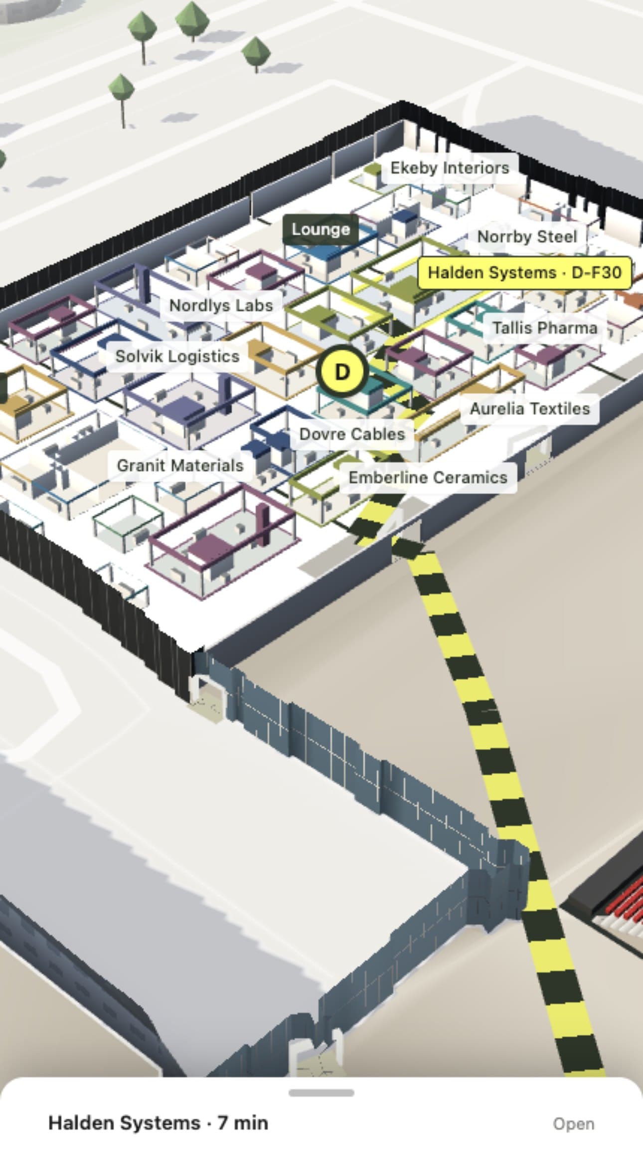
Visitors
“Where is the company I came to see?”
- Search by company, stand or country
- A walking route from the station to the stand
- Food, toilets and the nearest exit
- Opens from a link or a QR code at the entrance
Exhibitors
“Where do I unload, and where is my stand?”
- Their stand, its size and its neighbours
- The loading door and the way to the hall
- Their logo on their stand, on the map
- A report of how visitors found them
Organisers
“Will this hall fit my event?”
- Hall sizes, ceiling heights and capacities
- Which stands are sold and which are free
- The same map on the event website and the entrance screens
- Move a stand once, and every screen shows it
What the stand was worth.
Every search, stand view and route on the map is counted. After the show, each exhibitor receives a short report: how often visitors looked them up, opened their stand and asked for the way there. It all comes from the map, so there is nothing to install in the hall.
Organisers can include it with every stand or sell it as an extra.
Stand B12 · example
- Searches for you
- 312
- Stand views
- 1,240
- Routes to your stand
- 186
- Busiest hour
- Day 2, 11:00
We map it. You decide who keeps it.
You don’t start from a blank editor. Our mapping team maps the venue and your first event, then keeps both current for you or trains your team to.
- 01
Show us the venue
Send your hall drawings and one event’s floor plan before the call, and we’ll walk you through your own halls.
- 02
We map it
Our mapping team builds the venue from your DWG, PDF or a scan: halls, floors, entrances, parking and the walk from the station.
- 03
We map each event
Send the organiser’s floor plan and connect the event platform. Stands and exhibitors then update on their own until opening day.
Self-managed
We build your first map and train your team. After launch, your team makes changes in the map editor and publishes them, and we help when you need it.
Managed
We build the map and keep it current. Send us a change, such as an exhibitor moving stand, a refitted hall or a closed corridor, and our team makes it, checks it and publishes it.